| |
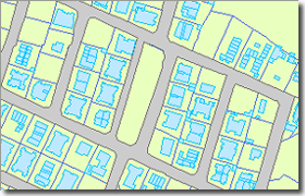
| Land Information Systems |
| • Map Information Systems |
| • Property Tax and Management |
| • Municipal GIS |
| • Urban Planning |
| • Environment Mapping |
| • Natural Resources Management |
| • Agriculture Management |
| • Watershed Management |
| • Forestry and Habitat Mapping |
|
|
| |
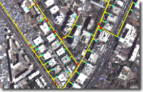
| Utilities and Networks |
| • Gas Pipeline Network |
| • Water Supply Network |
| • Waste Water Routing Network |
| • Electric Supply Network |
| • Telephone Networking |
| • Road/Rail Road Networking |
| • Distribution Networking |
| • Water Supply Network for Agriculture |
| • Analysis for best efficiency |
|
|
| |
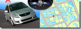
| Location Based Services |
| • Automated Vehicle Locating Systems (AVLS) |
| • BPO Services for Address Geocoding |
| • Multipurpose Vehicle Tracking |
| • Ideal Route for Delivery Vehicles |
|
|
| |
| 3D GIS |
| • 3D Urban Models |
| • 3D Terrain Analysis |
| • Cut-Fill Volumetric Analysis for Earthwork |
| • Contour Mapping and DTM Generation |
|
|
| |
| |